Welcome!
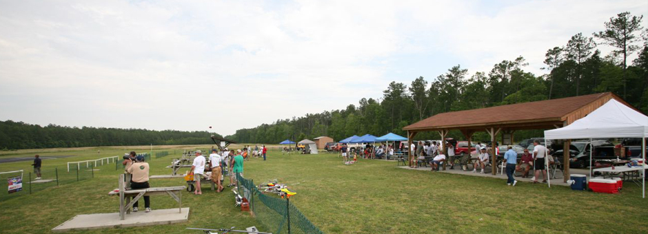
Newport News Park Radio Control Club (NNPRCC) is an Academy of Model Aeronautics Chartered Club (#3504). It was founded on January 3, 1994 and currently has 100+ active members that love building, flying, and talking about radio-controlled aircraft. The NNPRCC flying field is open to members from sunrise to sunset year-round and offers the following amenities:
- Paved 400’ runway
- Spacious 30 acre overfly area
- Bleachers for visitors & spectators
- Two shelters with picnic tables and on-site restroom
- Complimentary DC power supply for operating chargers & electronics
Visitors and guests are encouraged to stop by the NNPRCC flying field and meet existing club members. The busiest flying times are usually Saturday and Sunday afternoons (weather permitting). If you’re looking for a great place to fly your airplane, helicopter, multi-rotor (and more) or interact with other model aviation enthusiasts, join NNPRCC today!
NOTE: Due to the flying field’s proximity to Newport News / Williamsburg International Airport, operating radio-controlled aircraft above 400’ is strictly prohibited.
Is it a good day for flying? Check the local weather forecast.
Annual Events
- Chili Fly
- Swap Meet
- Louie Luau Fun Fly
- National Model Aviation Day
For details, see our Facebook page:
Directions
 Get directions using Google Maps.
From I-64 WEST: Take exit 250B toward Yorktown. Turn left at light and then turn right at next light onto Ft Eustis Blvd. Go 1.7 miles and turn right onto Richneck Rd (636). Go approximately 4/10s of a mile crossing railroad tracks. Turn left into gate and follow road to field.
From I-64 EAST: Take Exit 250B toward Yorktown. Continue through the light onto Ft Eustis Blvd. Go 1.7 miles and turn right onto Richneck Rd (636). Go approximately 4/10s of a mile crossing railroad tracks. Turn left into gate and follow road to field.
From Route 17: Turn left or right depending on direction of travel onto Ft Eustis Blvd (Rt 105). Go approximately 1.8 miles and turn left onto Richneck Rd (636). Drive until crossing over railroad tracks. Field entrance will be on left.
GPS Coordinates: 37 10 10.85 N, 76 30 32.43W

